montezumarchery
Very Active Member
- Messages
- 1,519
Reminds me of the poor guy who’s google maps sent him to Whitney reservoir by way of Gold Hill pass road, towing a 24’ trailer. Poor dude was about in tears when he flagged us asking for better directions.
Last year Butterfield Canyon above Herriman was blocked for a few hours by a tractor/trailer that tried to get to Tooele from Herriman by using similar electronic mapping.Reminds me of the poor guy who’s google maps sent him to Whitney reservoir by way of Gold Hill pass road, towing a 24’ trailer. Poor dude was about in tears when he flagged us asking for better directions.
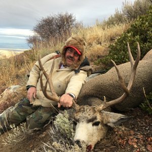
Dudes wife snapped that picture one day before she cashed in on his life insurance policy.

Haha, I was going to make a comment about that picture also.Dudes wife snapped that picture one day before she cashed in on his life insurance policy.
Been there done that & it’s terrifying.Haha, I was going to make a comment about that picture also.
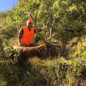
Was wondering where the wife was.
Reminds me of my wife wanting to go down a muddy crappy road with my new truck. At one point I was going to turn around when I finally reached a spot big enough right after the ass end almost slid down/off the edge.
Some how against my better judgement she convinced me to keep going. 1/4 mile more I crested a turn and realized there was no way I could go any further. Nothing like a 30 point turn on a 2 track road.
Gotcha. mtmuley
Wow. mtmuley