2022 G6 Hunt

jvtyree

New Member
Messages
4
Yep G6 this year. Read all the past posts I could here. I had a friend from Bakersfield pull this tag last year (2021) and harvested a decent buck once a storm (no snow though) came in. Buck was nothing like I’ve seen in Colorado archery hunting but decent for what I’ve seen around Kern County. I have a couple questions maybe some of you can answer…

Where to camp in this area during the hunting week? If snow does come in how far can a 4x4 truck drive around that area? Does forestry/CalTans plow the main roads there? Should I take my quad in case? There was a fire in that area maybe 10 years ago or so (???); anyone seen the vegetation growth after that fire?
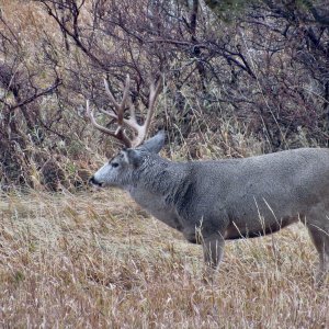
There was a fire in part of the hunt area the past 2 years. Castle Fire and Windy Fire. West side of the Kern around Lloyd Meadow Rd.
 
Call the forest service. They will tell you when they close the gates for the winter. Some of the upper camp grounds are still closed from tree damage from the drought and fire.
 
Also I would bring the quad. There are some side roads you can get into along the river to the east. Any thing in 20-22inch range if an above average buck for the area. Know lots of people that have had it and there are some good deer in there if you can find a little luck and hold off the trigger
 
Sentinal peak (I think)
20221018_091950.jpg
from the south in G6.....west side of kern river Oct 2022
 
In this picture one can see what I beleive is new growth in the fore ground. The burnt braches sticking up I assume the old growth before the 2021 fire. The lower in elevation browse areas below the pine areas (not in picture) appeared to have been mostly untouched?

20221018_092037.jpg
 
Yep G6 this year. Read all the past posts I could here. I had a friend from Bakersfield pull this tag last year (2021) and harvested a decent buck once a storm (no snow though) came in. Buck was nothing like I’ve seen in Colorado archery hunting but decent for what I’ve seen around Kern County. I have a couple questions maybe some of you can answer…

Where to camp in this area during the hunting week? If snow does come in how far can a 4x4 truck drive around that area? Does forestry/CalTans plow the main roads there? Should I take my quad in case? There was a fire in that area maybe 10 years ago or so (???); anyone seen the vegetation growth after that fire?
any updates? weather is on your side! Kill a big one! tracking in the snow is a rarity in cali,,,
 
Did get out minimally in G6 last weekend, without a tag. Although there was rain / snow for a majority of the weekend it seems some areas Kernville to Bishop and encompassing G3 and G6 are zero to roughly 50 percent of historical averages for precipitation for the rain year Oct to present in my review. G6 snow line about 6000 to 7000 feet?

Saw a forked horn harvested in G6. I jumped a 3 x 3 (I think) at about 6500 feet elevation on East side of the Kern River. I have no picture only saw him for 2-3 seconds. Photo of a 3 x 3 near Kernville that was a ways out the week before. Drove to locked gate on West side of the river.

Too old now to hike much
3 x 3 aa.jpg
except for short hikes. I saw fewer sign than years past at all elevations 3000 to 7000 feet.

Where are the hunter reports?
 
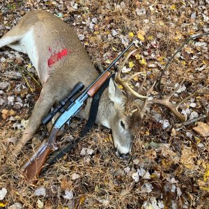
So here is my update. Got this guy on Sunday. He had forks on his right side but they broke off when he fell backwards. His left side was already broken. We saw one really big 4x4 for a couple days right out of our camp but our neighboring hunters took a 3x3 that was with the 4x4 on Saturday evening so we decided to let that area cool for a day or too before going back in. Saw a big forked horn that was well outside his ears on Friday on Cherry Hill Road. But Cherry Hill Road was absolutely packed with trucks everyday.

The Forestry Service literally shut down the road going into Peppermint on Friday as we were driving up there on Friday to get out and scout around. He told us it was because Tulare County shut down the road going into Johnsdale. Whatever…

Rained I think everyday and every night we were there. Made walking around in the mountains very very difficult.

50DC780D-CCD5-4204-9F37-DD2BD963F825.jpeg
 
So here is my update. Got this guy on Sunday. He had forks on his right side but they broke off when he fell backwards. His left side was already broken. We saw one really big 4x4 for a couple days right out of our camp but our neighboring hunters took a 3x3 that was with the 4x4 on Saturday evening so we decided to let that area cool for a day or too before going back in. Saw a big forked horn that was well outside his ears on Friday on Cherry Hill Road. But Cherry Hill Road was absolutely packed with trucks everyday.

The Forestry Service literally shut down the road going into Peppermint on Friday as we were driving up there on Friday to get out and scout around. He told us it was because Tulare County shut down the road going into Johnsdale. Whatever…

Rained I think everyday and every night we were there. Made walking around in the mountains very very difficult.

View attachment 96281
yeah i was there so angry at FS right now
 
"I hope all will call and write to tell FS"

Been there too....they don't care
Right? I still have a real strong feeling that they don't want us up there anyway. Any excuse to shut gates works for them. There's a bunch of closed gates and new closed gates where I hunt in D8 for "sAFeTy" from the Windy Fire damage. Some of them are miles away from the edge of the burn scar.
 
By far not the first time those roads were closed by the FS......no one got points back then....in G6....don't know about the other units. G6 was NOT closed because of fire...only roads were closed....not the area....this is BULLSH!T
 
Last edited:
Looks like you got a free hunt out of the deal and realized that’s not where you will want to burn your points now that you get them back. So where will you go with your points then ?
 
Lol, it,s not free, will get my points back but no refund on the tag cost. i live in the zone so i know the area well and its weather that makes it good or bad. Maybe just go back to trying for G3
 

Click-a-Pic ... Details & Bigger Photos

California Guides & Outfitters

Western Wildlife Adventures

Offering some fine Blacktail Deer hunting, Wild Pig hunts, Turkey hunts and Waterfowl hunts.

Urge 2 Hunt

We offer the top private land hunts in all of California, for blacktail deer, elk, pigs, bison and turkeys.

G & J Outdoors

Offering Tule elk hunts for bulls and cows on a 17,000 acre Ranch in Laytonville, CA with 100% success.

Back
Top Bottom