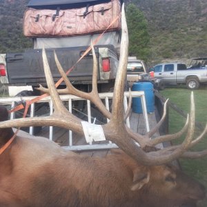
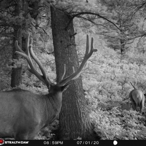
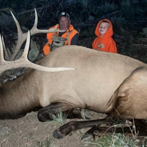
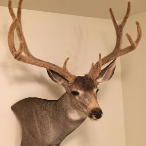
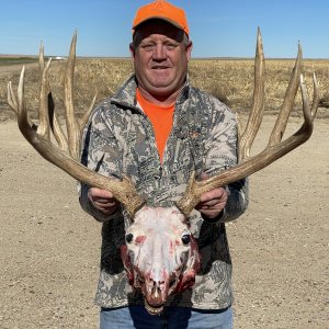
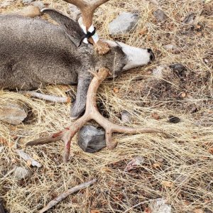
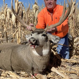
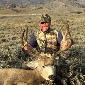
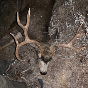
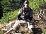
Harvested buck this year in a general unit. Approached the downed buck and was surprised to find it collared. Never seen a collared buck afield, let alone harvest one! Turned the collar into IDFW. Awaiting the data sheet from them that tells me the age, travels, etc on this great animal.

You are using an out of date browser. It may not display this or other websites correctly.
You should upgrade or use an alternative browser.
You should upgrade or use an alternative browser.
Idaho 2020
- Thread starter Spome
- Start date
Outdoordan
Very Active Member
- Messages
- 2,166
Great buck! Congrats, interesting that it was collared.
customweld
Active Member
- Messages
- 612
Wapitiwilly
Very Active Member
- Messages
- 2,410
Stud??
PacificFork
Active Member
- Messages
- 160
Great buck congrats! Please keep us posted on the age and how far he traveled!
yoteduster
Very Active Member
- Messages
- 2,312
Great buck...congrats
Spoke via phone with the Biologist out of the Magic Valley office about the data sheet, etc. She reported the the Buck was collared three 1/2 years ago at a wildlife area near Boise. Estimated age of the buck at that time was 4 years! (7 to 71/2 yrs old) Tracked it as far north, first year above Stanley. She didn't run though entire report. Just made her aware that I wanted the report and a prototype collar for the mount.
Mallards_Only
Active Member
- Messages
- 610
I have seen collared does before but no bucks. Pretty amazing to me that deer will travel that far especially when there are other wintering areas that seem to be within their travel route to the their final destination. Would be interesting to know how many miles that buck traveled every yr and just how high he went every spring and summer, only to return to the wintering ground every year. Do you mind saying what elevation he was killed at and when?
Westernhunter
Member
- Messages
- 23
Congrats on a great buck!Harvested buck this year in a general unit. Approached the downed buck and was surprised to find it collared. Never seen a collared buck afield, let alone harvest one! Turned the collar into IDFW. Awaiting the data sheet from them that tells me the age, travels, etc on this great animal.
View attachment 19376
PacificFork
Active Member
- Messages
- 160
Wow awesome, 7 1/2 years old is amazing.
Duck0Slayer
Member
- Messages
- 87
Found him alive ?
Matt

Matt
Blindnonresident
Active Member
- Messages
- 680
Congrats.
Wasn't aware males wore jewelry in Idaho.
Wasn't aware males wore jewelry in Idaho.
8100 ft. 13 th of October!I have seen collared does before but no bucks. Pretty amazing to me that deer will travel that far especially when there are other wintering areas that seem to be within their travel route to the their final destination. Would be interesting to know how many miles that buck traveled every yr and just how high he went every spring and summer, only to return to the wintering ground every year. Do you mind saying what elevation he was killed at and when?
Blindnonresident
Active Member
- Messages
- 680
It was a warm one last year.
Great buck.
Great buck.
backcountryID
Active Member
- Messages
- 213
Spome, congratulations on a very nice deer! If you have any more pictures, we'd all love to see them. He looks to have some cool features
Outdoordan
Very Active Member
- Messages
- 2,166
I'd like to know what you found out from the data. That is so cool!
blacktailBC
Active Member
- Messages
- 607
That’s pretty cool man, congrats
SanPitch
Active Member
- Messages
- 255
Post a picture of the mount when it’s done! I’d love too see itSpoke via phone with the Biologist out of the Magic Valley office about the data sheet, etc. She reported the the Buck was collared three 1/2 years ago at a wildlife area near Boise. Estimated age of the buck at that time was 4 years! (7 to 71/2 yrs old) Tracked it as far north, first year above Stanley. She didn't run though entire report. Just made her aware that I wanted the report and a prototype collar for the mount.
Katoom
Active Member
- Messages
- 609
All these people waiting for your data.....Will do MK. Taxidermist scored at 182. I'm still awaiting the report from the Magic Valley Biologist . Try monthly, to check on it. Its always in the mail "next week". I"ll post the data when I get it. Should be interesting!
Mallards_Only
Active Member
- Messages
- 610
^^Sounds about right.
Received the Migration/ location data via e mail. Still awaiting the narrative, capture card with measurements when it was tagged etc. The satellite pings appear daily and they are color coded by season. ie; Blue for Dec thru Feb, Green for spring, Red for summer and Yellow for Fall. This buck traveled from the wintering area east of Arrowrock reservoir to his summering area W/NW of Stanley Idaho - Deep in the Sawtooths. Using Google earth to trace his route, this buck traveled over 100 miles ea year between its summer and wintering areas. As noted above...seemed strange that the buck returned to the same wintering area year after year when other wintering areas seemed much closer. What do I know? The buck summered in a tight geographical area. I shot the buck close to its summering range but I think it was making its way back to its wintering area when I found him. Appears to be two years Data on this buck. Amazed that both years, the buck used the same route/corridors and seemed to be within a few miles of where he was the previous yr. (Seasonally) Enjoy!
Mallards_Only
Active Member
- Messages
- 610
That's pretty crazy. Just goes to show the value of wintering areas to herds from vast areas around the state. I think a lot of people take wintering areas for granted and because they see a lot of deer in there, they think the herd(s) are healthy without realizing that the number of deer in there is representative of thousands of square miles from the surrounding areas. Does the data show how long it took him to travel that 100 mi? I always wonder whether deer slowly saunter their way to wintering areas in the fall or, if once the weather hits, they make a beeline for it and don't stop until they get there.
Mallards....Data isn't date specific. Clearly the buck was in his wintering area by late Nov and began his trek in early October. The pace of travel I think is dependent on the weather...available feed etc. The buck appeared to leave wintering area and make it about half way to its summering area by early May, using low elevation corridors. Appears to reach his summering areas by June and leaves early to mid October. Small sample.... interesting none the less.
GSJ
Active Member
- Messages
- 354
Fascinating. Great information thanks for posting that.Received the Migration/ location data via e mail. Still awaiting the narrative, capture card with measurements when it was tagged etc. The satellite pings appear daily and they are color coded by season. ie; Blue for Dec thru Feb, Green for spring, Red for summer and Yellow for Fall. This buck traveled from the wintering area east of Arrowrock reservoir to his summering area W/NW of Stanley Idaho - Deep in the Sawtooths. Using Google earth to trace his route, this buck traveled over 100 miles ea year between its summer and wintering areas. As noted above...seemed strange that the buck returned to the same wintering area year after year when other wintering areas seemed much closer. What do I know? The buck summered in a tight geographical area. I shot the buck close to its summering range but I think it was making its way back to its wintering area when I found him. Appears to be two years Data on this buck. Amazed that both years, the buck used the same route/corridors and seemed to be within a few miles of where he was the previous yr. (Seasonally) Enjoy!
Blindnonresident
Active Member
- Messages
- 680
Cool Stuff.
Thanks
Thanks
Duck0Slayer
Member
- Messages
- 87
Very cool information!
Matt
Matt
HORNhunter7
Active Member
- Messages
- 303
As others have said-- Thanks for sharing this info. It makes your hunt even more memorable and a story family and friends will have trouble topping sitting around the campfire reminiscing!
Idaho Hunting Guides & Outfitters
 Bearpaw Outfitters
Idaho Deer & Elk Allocation Tags, Plus Bear, Bison, Lion, Moose, Turkey and Montana Prairie Dogs.
 Urge 2 Hunt
We focus on trophy elk, mule deer, whitetail, bear, lion and wolf hunts and spend hundreds of hours scouting.
 Jokers Wild Outdoors
Trophy elk, whitetail, mule deer, antelope, bear and moose hunts. 35k acres of private land.

